
Finding People Along a San Marcos Street
The best street directory workflow is a chain, not a bulk name grab. Begin with one exact address. Confirm whether it falls inside the incorporated city or only uses a San Marcos postal line. Find the APN in the county assessor or GIS layer. Read the parcel attributes, then use the current owner or another known party in the recorder index. Permits can add activity at the site. A court, approved voter-file request, or library volume may answer a different question about a person or past year.
- Normalize the street number, direction, suffix, unit, ZIP, and likely jurisdiction.
- Use the San Diego County assessment search or GIS to identify the parcel and APN.
- Open the parcel in the county or San Marcos map and inspect adjacent lots one at a time.
- Search ARCC by grantor, grantee, document type, date, document number, or book and page.
- Add a permit, public-record request, historical directory, or identity-gated voter source only when its purpose fits.
This order protects against a common error: treating a street name as if it were a household key. The APN and legal description make the land stable while names, postal lines, and street labels shift.
Normalize a San Marcos Street Address
San Marcos addresses can cross a practical records boundary. A postal line may say San Marcos while the parcel lies outside the incorporated city, including the Lake San Marcos census-designated place. The county GIS layer and city GIS hub help establish jurisdiction, zoning, general-plan setting, and nearby parcels. Use the full situs address for the first search, then try a form without direction or street type when the county tool instructs.
Unit detail matters for condominiums and other divided property. The assessor search has a Unit field, and county GIS attributes can include suite, building, unit quantity, subdivision, and effective year. A shared street number can point to more than one APN. Write down the legal description before comparing any party name.
The San Diego County GIS catalog, San Marcos city GIS resources, and San Marcos GIS hub are map resources. They are not open owner-name directories.
San Marcos Address to APN
The secured assessment roll offers Parcel Number, Address, or Street Name mode. Address search uses street number and street name. Street Name mode can surface parcels without a normal number and helps when the aim is a whole-road review. The parcel card may show situs, legal description, tax-rate area, assessed land and improvements, exemptions, property characteristics, and a mailing destination subject to suppression rules.
| APN | One parcel key; county instructions specify the accepted punctuation and digit count. |
|---|---|
| Street Number | Numeric address part used with the address mode. |
| Street Name | Autocomplete or text field; omit direction or suffix if a no-match instruction says to do so. |
| Unit | Optional condo or unit detail that may separate related APNs. |
| Search / Reset | Submit the form or clear its criteria before trying a new address form. |
California Government Code section 6254.21 also affects name-based posting of protected officials' home addresses. The public web roll is therefore shaped by privacy law as well as by the search design. If an owner or mailing field is absent, do not infer that the parcel has no owner.
Browse a San Marcos Block
The official San Marcos parcel FeatureServer supports query and extract functions, has a maximum record count of 2,000, and exposes parcel geometry without an owner-name field. Its attributes can include APN, legal description, acreage, document number and date, tax status, situs ZIP, jurisdiction, street direction, subdivision, living area, bedrooms, baths, garage, pool, and related map fields. Zoning, floodplain, council district, and site-address layers add context.
Map browsing is simple when kept narrow: geocode the target, select its polygon, read the APN and attributes, then click or select an adjacent polygon. A radius or buffer selects geography, not people. Export availability depends on the application and should not be assumed. Each adjacent parcel still needs its own lawful assessment or record check.
The official parcel layer shows why a map can guide a street directory without becoming one.
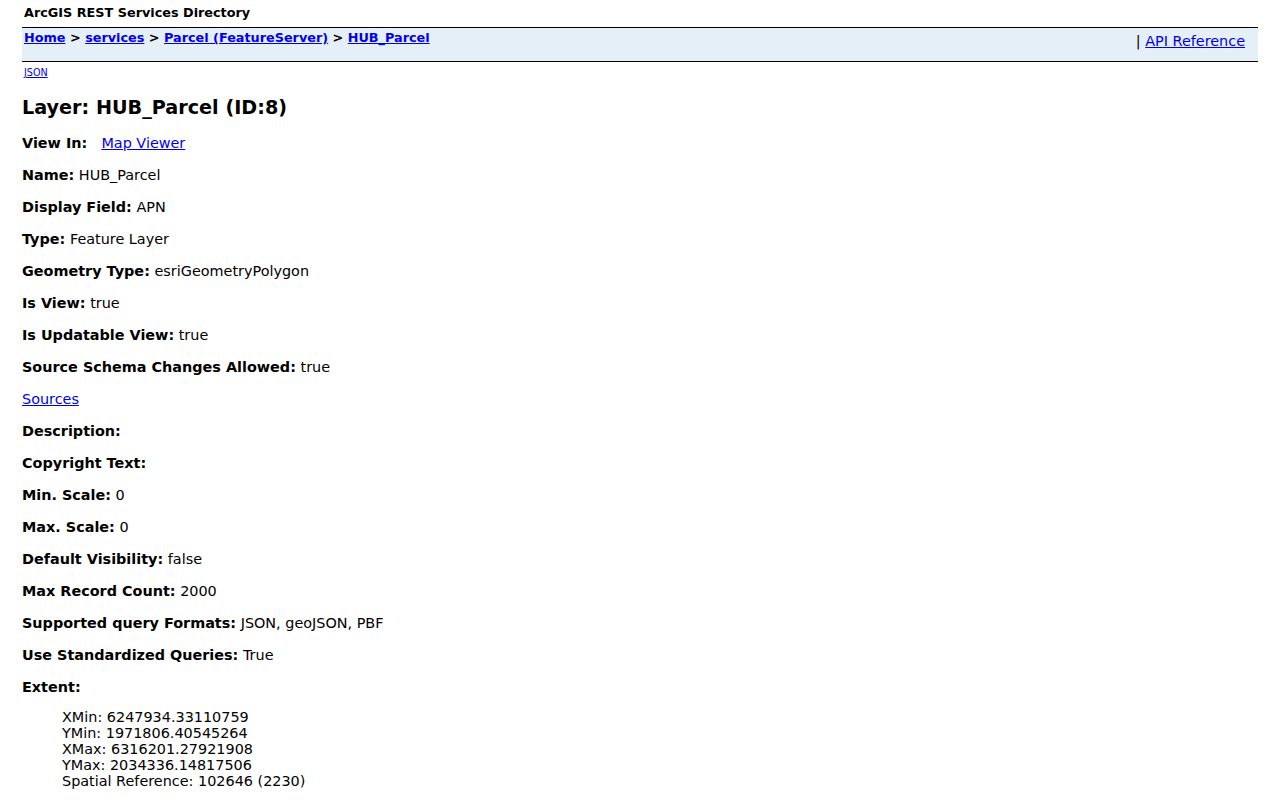
The parcel image is useful for tracing land shape, APN, subdivision, and jurisdiction while leaving person claims to the right custodian.
San Marcos Records Searchable by Street
Address-keyed records answer different parts of a street question. The coverage table keeps ownership, geography, activity, and voter information from being blended into one claim.
| Record Set | Keeper | What It Shows | Access |
|---|---|---|---|
| Assessment roll | San Diego County Assessor | Parcel, assessed values, owner or mailing clue, traits | Address, street, counter, or request |
| GIS parcel map | County and San Marcos GIS | Geometry, APN, jurisdiction, zoning and layers | Free map services |
| Deeds and liens | ARCC Recorder | Named parties, transfer or lien dates, legal description | 1970-present web; kiosk and archive paths |
| Permits and inspections | San Marcos Development Services | Applicant, contractor, work, status, inspection dates | Current or legacy portal; targeted request |
| Approved voter file | San Diego Registrar | Purpose-approved registration geography and fields | Written application only |
| Criss-cross volume | Library or archive | Historical occupant or telephone clue by street number | Reference collection; local years unverified |
An APN can join the assessment roll to a deed and a permit. It does not join a renter to the parcel. A street name can help locate a voter-file geography, but only an approved request can lawfully supply that file. That is why the San Marcos street directory works best as a labeled record chain.
San Marcos Mailing and Situs Addresses
A situs address describes where the parcel sits. A mailing address is where a tax notice or other county correspondence is sent. The two can match, but they can also differ. A different mailing line may suggest an out-of-area owner, an agent, a trust, or another administrative arrangement. It never proves who occupies the San Marcos property.
Property cards can also expose an owner-occupancy flag or exemption signal. Those facts are supporting evidence only. They should be read beside the legal description, deed vesting language, and date of the assessment cycle. A tax mailing line is not a resident roster, and a deed is not an occupancy affidavit.
Read the labels. Keep situs, mailing destination, owner, grantor, grantee, applicant, and occupant in separate fields so a street directory does not overstate what a record says.
San Marcos Permit Activity
San Marcos permit systems changed on January 2, 2025. New NREL Solar App, commercial, and building permits moved to Clariti/Camino, while legacy eTRAKiT remains at the older permit portal. The inspection view can expose Permit, Address, Inspection, Inspector, Time, Result, Completed, and Scheduled Time. A sample observed record was permit GP23-00015 at 1020 W San Marcos Boulevard for a Structural Concrete inspection.
That sample shows activity evidence, not the inspector's or applicant's residence. Older files may need an exact street address, APN, and record type in a City Clerk request. Plans and attachments can be redacted. Permit history is most useful for dating a building, alteration, or subdivision phase before pairing the site with other records.
The current permit source has a distinct path from the legacy inspection view.
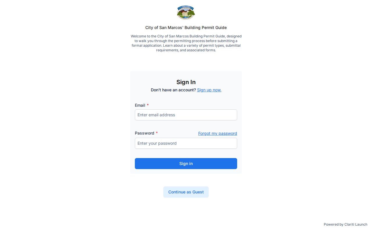
Use the current portal for newer activity and the legacy system when the record's date points to the older interface.
The legacy system remains relevant for older inspection trails.
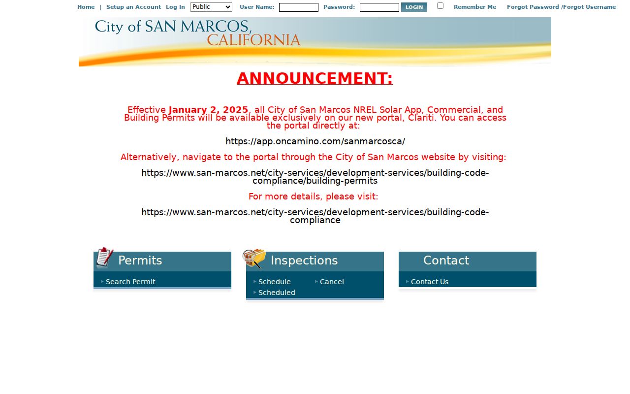
Two permit portals can describe one address across a system change, so the search date and system name belong in the notes.
San Marcos Deed Chain After 2024
The ARCC Official Records Index is free to search from 1970 forward. Search a known owner as grantee for the likely acquisition, then read the document number, date, grantor, grantee, document type, and legal description. Search that grantor as an earlier grantee and repeat. Deeds of trust are financing evidence, not ownership transfers. The same-name check must include the lot, subdivision, legal description, and date.
APN-only searching left the online index on December 9, 2024 under AB 1785. APN searching remains available at public kiosks in ARCC offices. If a web name search cannot bridge the parcel, get the APN from assessor or GIS, use the kiosk, or move to the County Archives for deeds from 1846 through 1969. Recent recordings may take 24 to 48 hours to appear. Index access and image access are separate.
Recorder staff can be reached at (619) 238-8158 or (619) 237-0502. A copy request can be made by account, kiosk, or mail, with the document number, year, at least one party, and document type. The stated copy price is $2 for the first page plus $0.05 per added page, with certification at $1 per document and a card surcharge.
San Marcos Criss-Cross Directories
A name-first city directory is not the same as an address-first criss-cross directory. The latter may arrange a street by intersecting road and house number, then name a householder or business, mark an owner or renter, and sometimes give a telephone. Exact San Marcos and North County year runs are not verified in an official online finding aid, so the San Diego County Library, San Diego Public Library Special Collections, San Diego History Center, and CSUSM reference staff should confirm each volume.
When a local volume is in hand, photograph or transcribe its title page and abbreviation key first. Check the street section, then the alphabetic section. Compare neighboring editions, pair a directory year with the 1950 census, and use a deed or parcel record for land identity. A missing entry may mean a move, death, an unlisted number, a coverage gap, or a publisher error.
The historical directory shelf belongs to the San Marcos city directory workflow, while this street directory stays focused on the current address chain.
San Marcos ZIP and City Lines
ZIP Codes describe USPS delivery routes, not municipal boundaries. San Marcos uses 92069 and 92078 for standard city geography, while 92096 identifies CSUSM and 92079 is treated in the research as a PO-box code that still needs live USPS validation. Lake San Marcos uses a 92078 mailing line even when city responsibility differs. Validate one address with USPS ZIP Lookup, then use GIS to settle the incorporated boundary.
Street records follow named streets, subdivision plats, APNs, and legal descriptions rather than one civic quadrant system. Engineering handles street naming, renaming, map correction, lot legality, and street vacation processes. The address may carry a postal label while the permit, parcel, and public-record custodian remain county or city specific.
The USPS address and ZIP lookup verifies the delivery line before a parcel search begins.
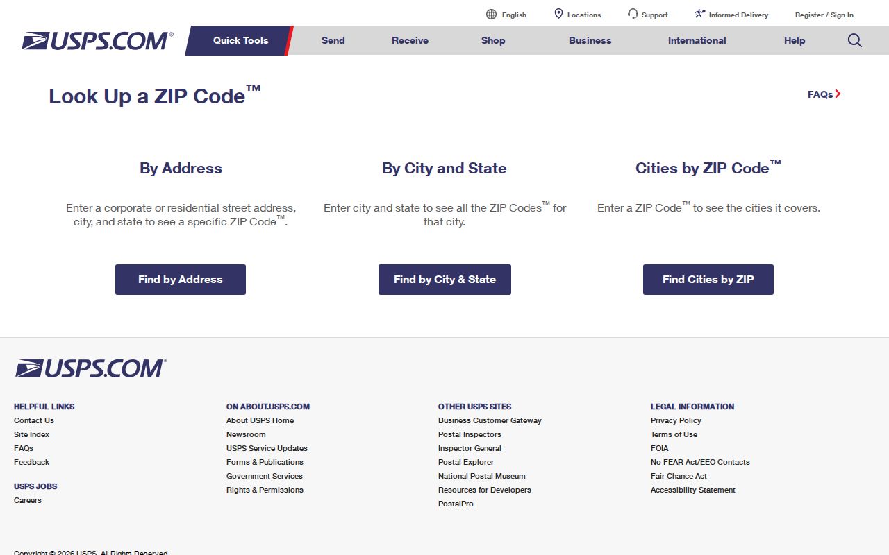
Postal verification narrows the search, while GIS and the APN settle the physical and legal location.
San Marcos Street Directory Limits
A San Marcos street directory cannot lawfully reveal every person at an address. DMV data is restricted by the federal DPPA. Utility customer accounts, delivery records, unlisted renters, household composition, and protected addresses are not open street fields. An approved voter file has purpose limits, and Safe at Home can hide a registrant through a substitute address. Court, adoption, confidential-marriage, and sealed files have their own barriers.
Commercial people-finder services may merge same-name records, retain stale addresses, and omit context. They are not a substitute for ARCC, the court clerk, the Registrar, a library, or a public-record custodian. When a record matters, save the source link, search date, document number, and the exact fact the record supports.
A street directory entry should state whether it shows a parcel, recorded party, permit applicant, historical occupant, or approved registration clue.
Lawful use. Street and address records are for lawful personal research, family history, civic review, and property curiosity. Do not use them to stalk, harass, intimidate, or harm a person.